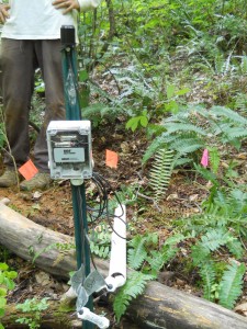
Moisture sensors measure the volumetric water content (volume of water per volume of soil) within the soil and can help determine flow paths that water takes during a storm. By understanding the fluctuations of soil moisture we can see whether flow moves vertically or laterally during and after precipitation events.
Soil moisture measurements can also help us answer the following questions:
- Does infiltrating water move deeply and recharge the groundwater table or move laterally?
- How rapidly does water move down into the soil during infiltration?
- Is the distribution of soil moisture related to topography?
- Is there a soil moisture threshold that triggers stream response?
At Glacier and Wind, there are three sites, which represent the shoulder, backslope and footslope positions of the hillslope. The sensors are aligned at each of these positions, hoping to observe lateral water flow over a given period of time. By vertically aligning the sensors at 15cm, 35cm, and 75cm from the surface, possible vertical flow may be observed. For a diagram of the sites or pictures of the moisture sensors click here. Information about the installation techniques can be accessed below.
